
Joseph S. D’Aleo, CCM
Last summer when Alaska reached 90F, many claimed it unprecedented. The record for Alaska actually was 100F at Fort Yukon June 27, 1915, near the summer solstice. A big turn around took place this winter. I haven’t heard much about it.


 Fairbank’s average 2019/20 daytime high was -2.1F, while the daytime low -20F, average daily mean was -11F!
The coldest was -43F while the warmest was 31F December 9. 33 days were at or below -30F, 5 were at or below -40F.
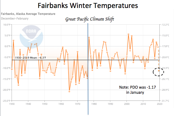
The winter averaged 4.7F below normal, the coldest (3rd) since before the Great Pacific Climate Shift (a shift of the so called Pacific Decadal Oscillation to positive) in the late 1970s when warmer Pacific waters favored warmth in Alaska and western North America.
See how the world’s oceans in the year of the lowest sunspot action in at least a century cooled (here I used change in the anomalies to remove seasonal changes).

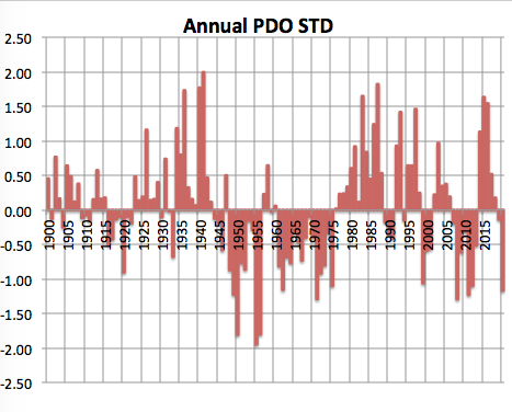
Note NOAA estimated the PDO in January as -1.17, characteristic of the colder periods 1950s to 1970s. We had a few periods in the late 90s and early 2000s where it teased us with negative PDOs, which flattened the warming curves (the pause).
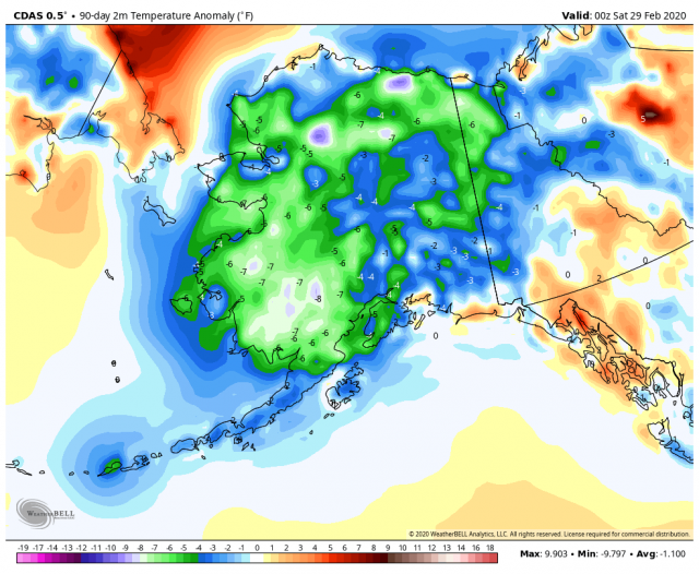
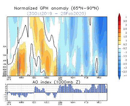
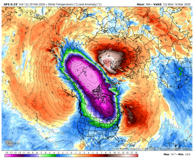
 See how the polar high atmosphere (vertical cross section of temperature anomalies 60-90N) cooled dramatically after late December and remains that way at the end of meteorological winter. Temperatures there are record cold for so late.

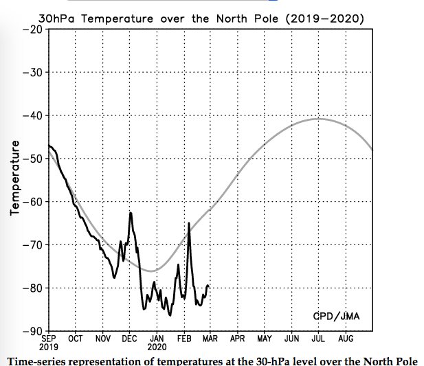
 Models suggest that continues at record low levels. Here is a two week forecast (50mb).
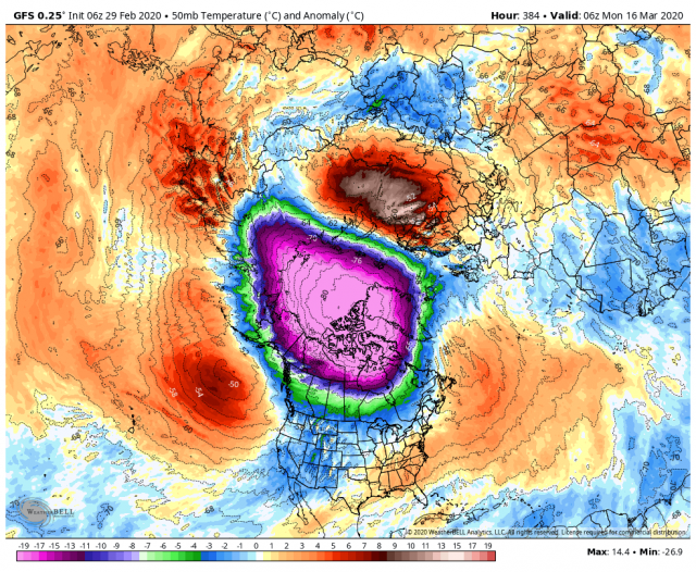
The cold arctic favors what we call a zonal flow that drives milder Pacific air inland into North America and from Atlantic into Eurasia.
.png)
 We lost a big chunk of winter in the lower 48 despite a cold start in November and very early December as the Madden Julian Oscillation shifted into warmer regions with the demise of the positive IOD in the Indian Ocean (that led to record crops in India and drought in Australia.) When it weakened and it started looking in the models the cold would return, the high arctic cold that danced for weeks with a warm pool settled into the western arctic. That meant a positive AO and NAO (and EPO) states that favor zonal flow into the land-masses from the oceans.
The cold pool will break down and it may or may not do it in a way that brings surprises. March is often fickle and anything can happen as the sun begins operating on the land and atmosphere. When the cold pool and three wave pinwheel begins to break down we would have the best chance of one or late surprises. The first hint was on the Saturday GFS with a fickle finger of cold into the U.S. Regardless,
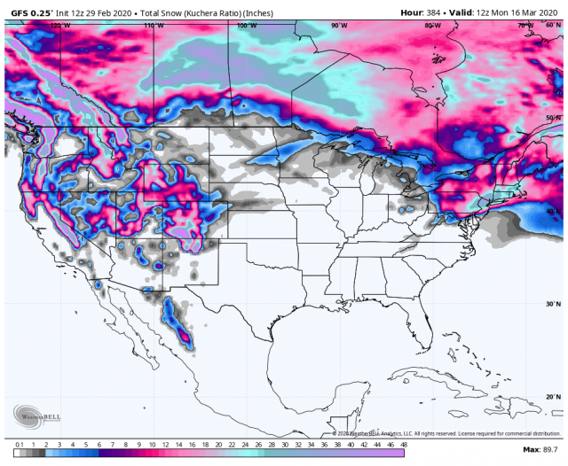
As is often the case at this time range, the model backed off the next run.
At this point we all are saying ‘I’ll believe it when i am out shovelling.”
Most in the lower 48 are saying ‘what winter?, Alaskans are saying “What a winter!”.
